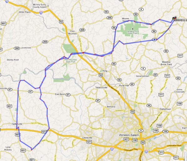
Round trip — more than 100 miles
I drove to Yadkin County today to visit family. It was good weather for photography, and the leaves were just beginning to turn, so I figured it was a good day to document the route from northern Stokes County, where I live, to the Yadkin Valley, where most of my family live, and where I grew up.
When I made the decision to move to Stokes County from California, it was after much deliberation. I weighed many factors. It’s hard to get to northern Stokes County. The roads are narrow, and crooked. Most people would need a map. It’s not a place where a commuter would want to live. But to me, these were positives, not negatives. I wanted to find a sweet spot between remoteness and access to commercial and medical centers. If I want to shop at Whole Foods, I can get to one (in Winston-Salem) in about an hour. If I needed to get to a major medical center, that’s also about an hour by road, but a few minutes by helicopter. And they do have helicopters.
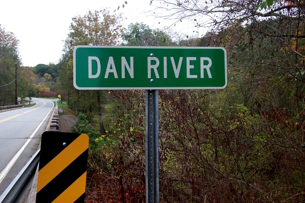
If I want to visit family in Yadkin County, I have to drive for more than an hour. But what a drive it is. The route crosses two rivers (the Dan and the Yadkin), and runs through the shadows of the Sauratown Mountain range. Stokes County is so isolated that it has its own little isolated mountain range! It’s some of the best scenery to be found in the Yadkin Valley and the Blue Ridge foothills.
So here’s a photographic essay on the trip from my house to my mother’s house in Yadkin County. For the sake of photographic honesty, please be aware that I have focused on the picturesque and the historic. There’s plenty of plainness and a certain amount of rural squalor along the way. But why takes pictures of that?
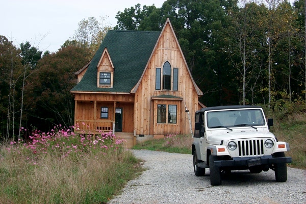
Leaving home. Now that the house is done, I need to get started on the landscaping, don’t I?
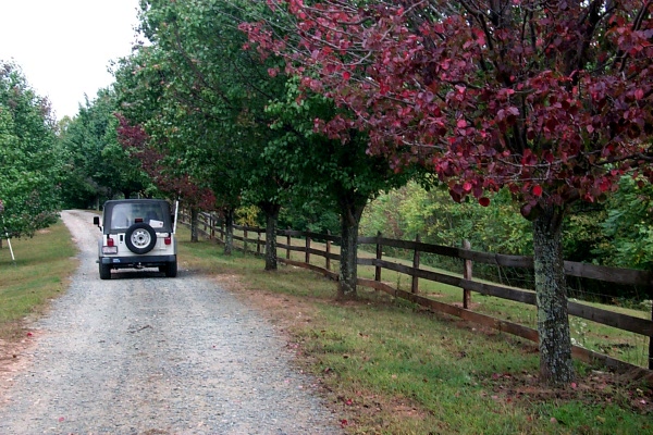
The unpaved road above my house, past a neighbor’s horse pasture
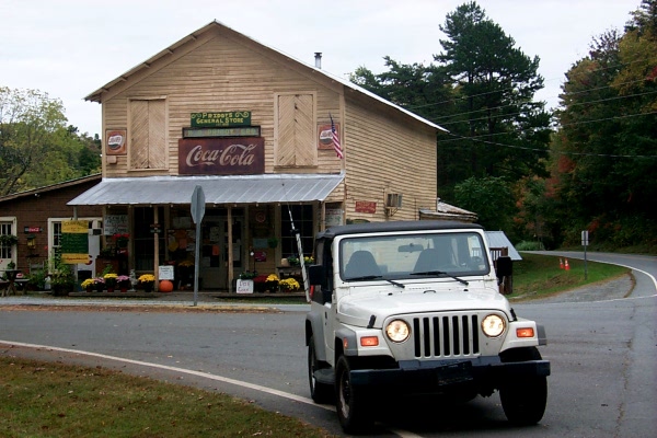
Priddy’s General Store, which appeared in the cult film Cabin Fever
The Dan River at Danbury
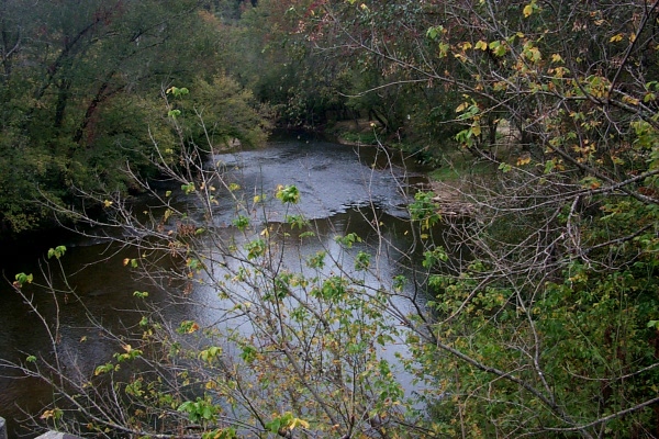
The Dan River at Danbury
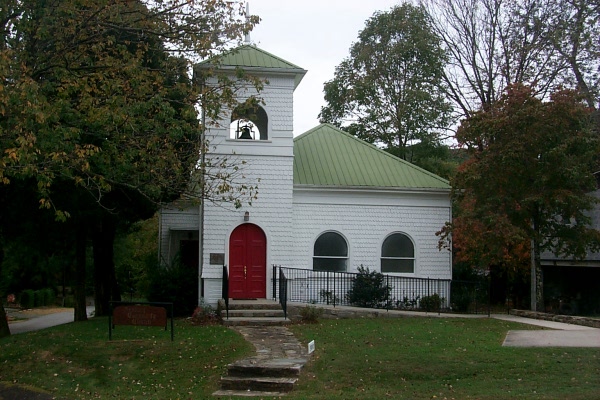
This building in Danbury was once a church. Now AA meets there, according to the sign out front.
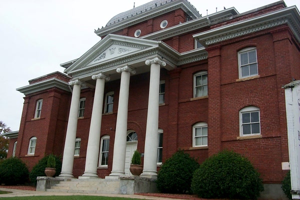
The old Stokes County courthouse
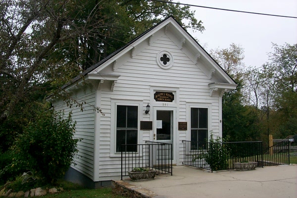
I believe this used to be the Danbury town hall. Now it’s a lawyer’s office.
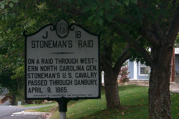
A historic marker in Danbury
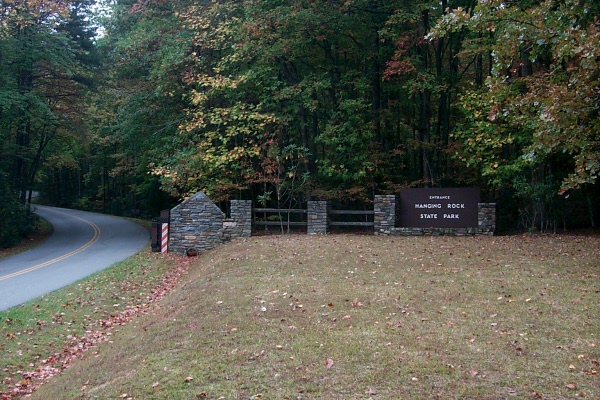
The entrance to Hanging Rock State Park, a few miles from Danbury. Just as in California, state parks are often under-appreciated, and awesome.
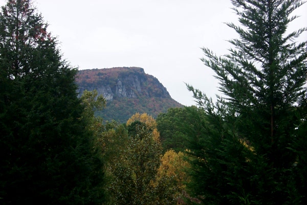
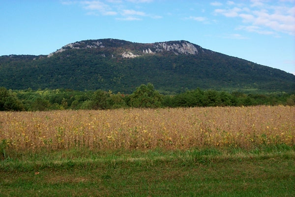
Hanging Rock, from Moore’s Spring Road
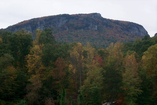
Hanging Rock, also from Moore’s Spring Road
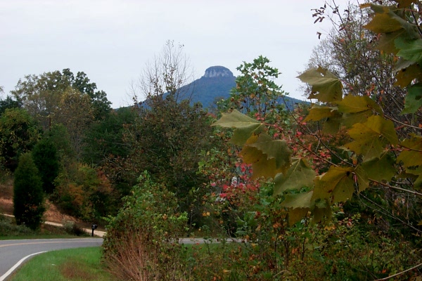
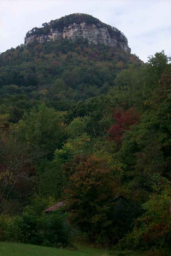
Approaching Pilot Mountain. Do you know the word “monadnock”? Culturally, the thing to know about Pilot Mountain is that it was called “Mount Pilot” in the Andy Griffith Show. This is Mayberry Country, remember.
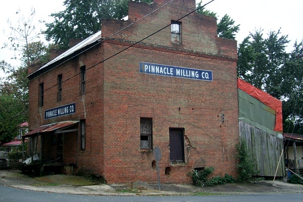
Old mill at Pinnacle. Pinnacle was the setting for the indie movie Junebug.
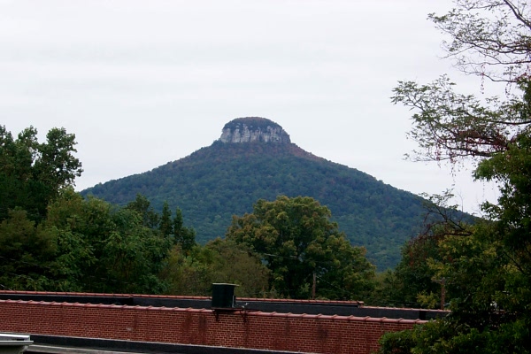
Pilot Mountain, looking over the roof of the Pinnacle post office

A pumpkin patch on the south side of Pilot Mountain
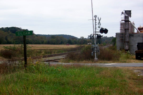
Coming into Siloam
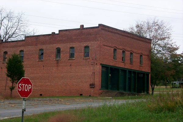
An old storefront in Siloam. If agricultural tourism and the popularity of the Yadkin Valley Wine Region ever reach critical mass, what a great little restaurant this would make.
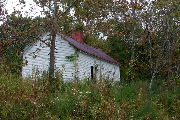
Across the road from the Siloam storefront. I have no idea what this little building is, but it must have some historical importance, because someone keeps it up.
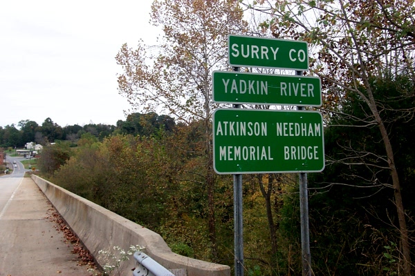
Siloam will probably forever remain known for the night of Feb. 23, 1975, when an old suspension bridge across the Yadkin River collapsed, killing four people and injuring 16. This is the new bridge.
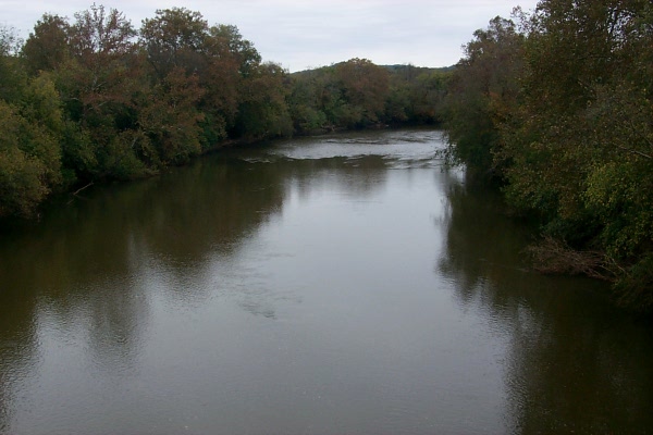
The Yadkin River at Siloam
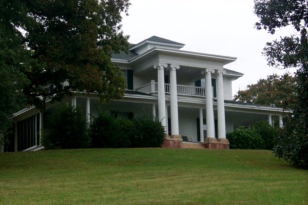
The big house at Siloam. Grand farms were not the rule in this area. Small family farms were much more common. But Siloam clearly was once a hot spot. Not only was there fertile land in the river bottom, but there was also a railway line. It clearly was enough to make a few farmers rich.
Pilot Mountain again, when I passed it on my way home
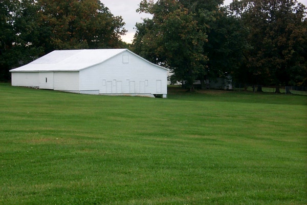
The history of this area — at least the agricultural history — is best read in the remaining outbuildings. Certainly more than a few big barns like this one remain. More modest barns on the old family farms are common, and hundreds if not thousands of old tobacco barns remain. Still, an untold number of fine old outbuildings have fallen down and rotted away.
The south side of Hanging Rock State Park, on my way home
3 Comments
I was completely taken aback when I saw the pics you had taken while on your drive! My Mother (Pauline Wall) was born in that old storehouse & lived there til she married my father(Neal Scott) in 1938, at which time they moved into the little house you had taken a pic of, and that is where my brother (Larry Scott) was born.
My Mom’s very best friend lived in the ‘big house’ up on the hill above the river.
The old storefront was a store on one side & a mill on the other. My Mom with her parents (Archillis, better known as Kellis & Iris Wall) lived up over the store.
Eventually my parents moved to Shoals. My grandfather sold the store & moved to Winston after my grandmother died in 1941.
My mother’s sister lived in East bend, when we went to visit her, we had to cross the bridge that fell in 1975. As a child, I was petrified of that bridge, would get down in the floor board of the car & cover my head and cry till we got across it.
We moved to Greensboro in 1951, when I was 6. We continued to visit my aunt in East Bend until she passed in the 70’s. I continued to be peterfied of that bridge! I would drive my Mom up to visit her sister & her friend & I still HATED that bridge! I do not have a fear of bridges, but there was something about that bridge that would cause me to become almost hysterical!
Am planning on a trip up there again soon.
My Mom’s mother, father, 2 brother’s (Howard & Jerry Wall) & sister (Bessie Wall Hardy) are buried at the church right up the hill from the big house.
Thank you for sharing these pics.
Brenda Scott Wrenn
papajo@northstate.net
How nice to have someone fill in the history of some of the photos. Many thanks…
the little white building into the weeds is the old train depot. Yes, the train did enable a little business district along 1003 in the early 1900’s. there is knowledge in the community of the basic layout of houses and businesses. It was at one time the best way to travel to Winston Salem. The daughter of the lady who owns the big house on the hill is very involved with the area history
Post a Comment