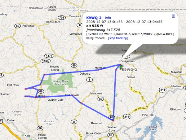
The track I followed today to Walnut Cove, then to Sauratown Mountain (getting lost on the way), then back home past Hanging Rock State Park and through Danbury.
I’ve made some improvements in my “Where’s David” GPS system that make it practical for me to use the system any time the Jeep is on the road.
The old system used a Garmin eTrex Legend handheld GPS device. When I wanted to use it, I had to make sure the Garmin device’s batteries were charged, put it in the back window of the Jeep, and plug it into the VHF transceiver. I wanted a system permanently hooked to the Jeep and drawing the Jeep’s power, the same way the VHF transceiver is hooked up.
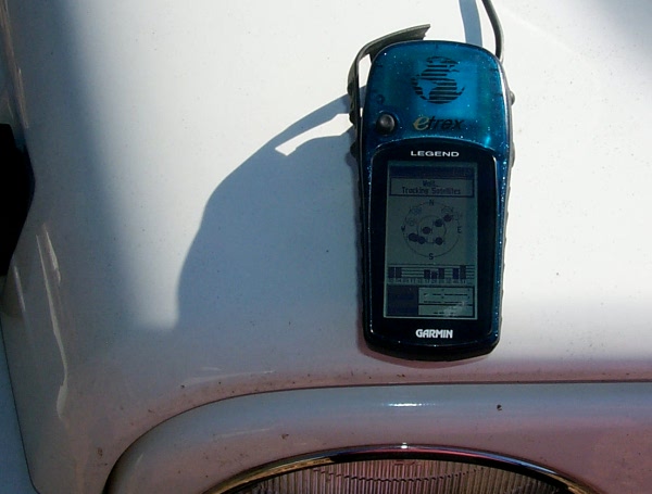
The GPS device I previously used, now retired — a Garmin eTrex Legend
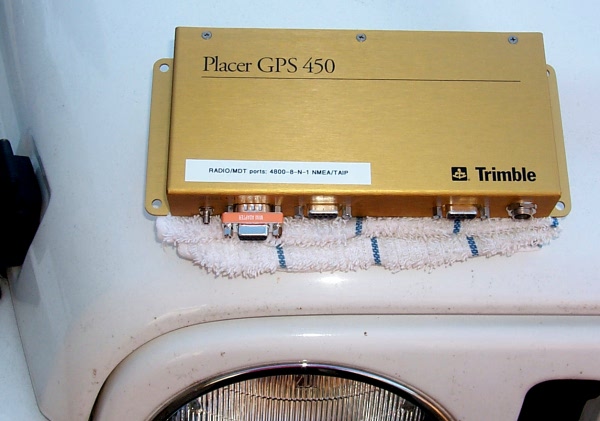
The new GPS device — a Trimble Placer 450
The new GPS device, a Trimble Placer 450, is made for permanent installation in vehicles. The devices are made for the commercial fleet-tracking market. I connected it to the Jeep’s wiring, and it’s safely mounted in the trunk of the Jeep along with my VHF transceiver. The Placer unit also has an exterior antenna, so it gets stronger signals from the GPS satellites
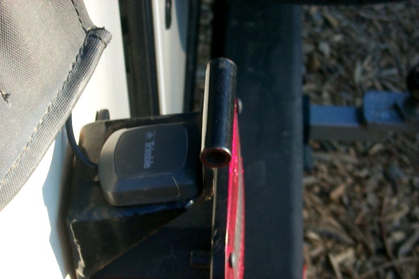
The Placer GPS unit’s satellite antenna, outside on the back of the Jeep
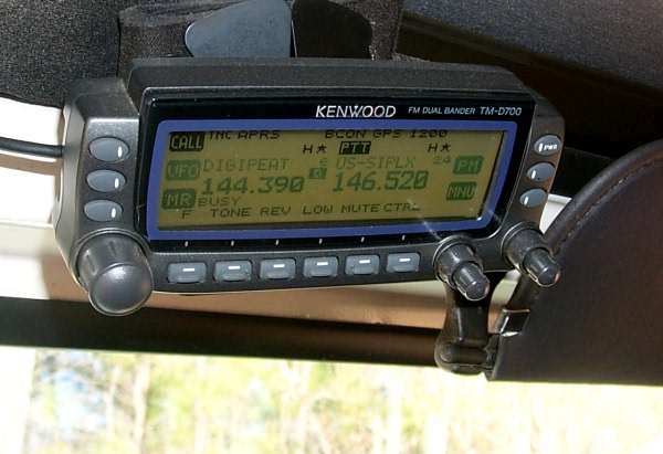
The control panel for the VHF transceiver is mounted above the windshield
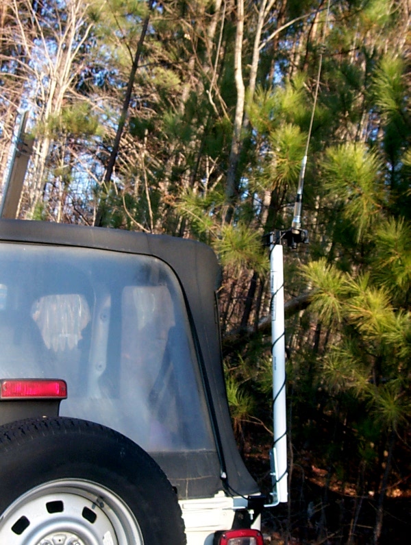
The VHF transceiver’s antenna is on a short mast on the back of the Jeep
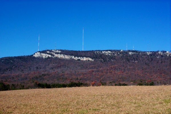
Sauratown Mountain
How it works: The Placer GPS unit monitors the Jeep’s position, speed, heading, and altitude. The Placer GPS unit constantly sends this data to the VHF transceiver, a Kenwood TM-D700, through a wired serial connection. Every so many minutes, the TM-D700 transmits an AX.25 APRS packet on a ham frequency reserved for this purpose — 144.390 Mhz. These packets are almost always heard by a ham “digipeater” or internet gateway station which puts the location information into an Internet database operated by hams. Once this is in the database, anyone can look at, and map, the data. Amateur radio transmissions, by law, are open to all who want to listen. One must have an amateur radio license to operate the VHF transceiver and make the transmissions, though. That is, a license is required to transmit, but anyone can listen. The Kenwood TM-D700 is well suited to this GPS location mechanism, because it has built-in digital capabilities, with a device called a “terminal node controller.”
About Sauratown Mountain: Stokes County has its own little mountain range, the Sauratown Mountains. Two of these mountains, Hanging Rock and Pilot Mountain, are state parks. However, one of the mountains, Sauratown Mountain, has been used for decades as a site for radio and television antenna towers. On a clear day, one can see 60 miles or more. Since VHF radio frequencies follow a line of sight, from the top of Sauratown Mountain one can communicate nicely on VHF frequencies. While I was on Sauratown Mountain this morning testing the new system, I spoke with KG4IXS, who is 16 miles northeast of Danville, Virginia, almost 70 miles away. The Kenwood transceiver can, of course, handle both digital and voice communication.
How to find David: There are a couple of links to the right here on the blog under “Where’s David?”
Post a Comment