

Click here for high-resolution version.
The abbey is only 15 miles south of the Virginia state line, and the new Fiat 500 drives like a mini-Ferrari (while sipping gasoline). I can be on the Blue Ridge Parkway in a hop and a skip. Road trip!
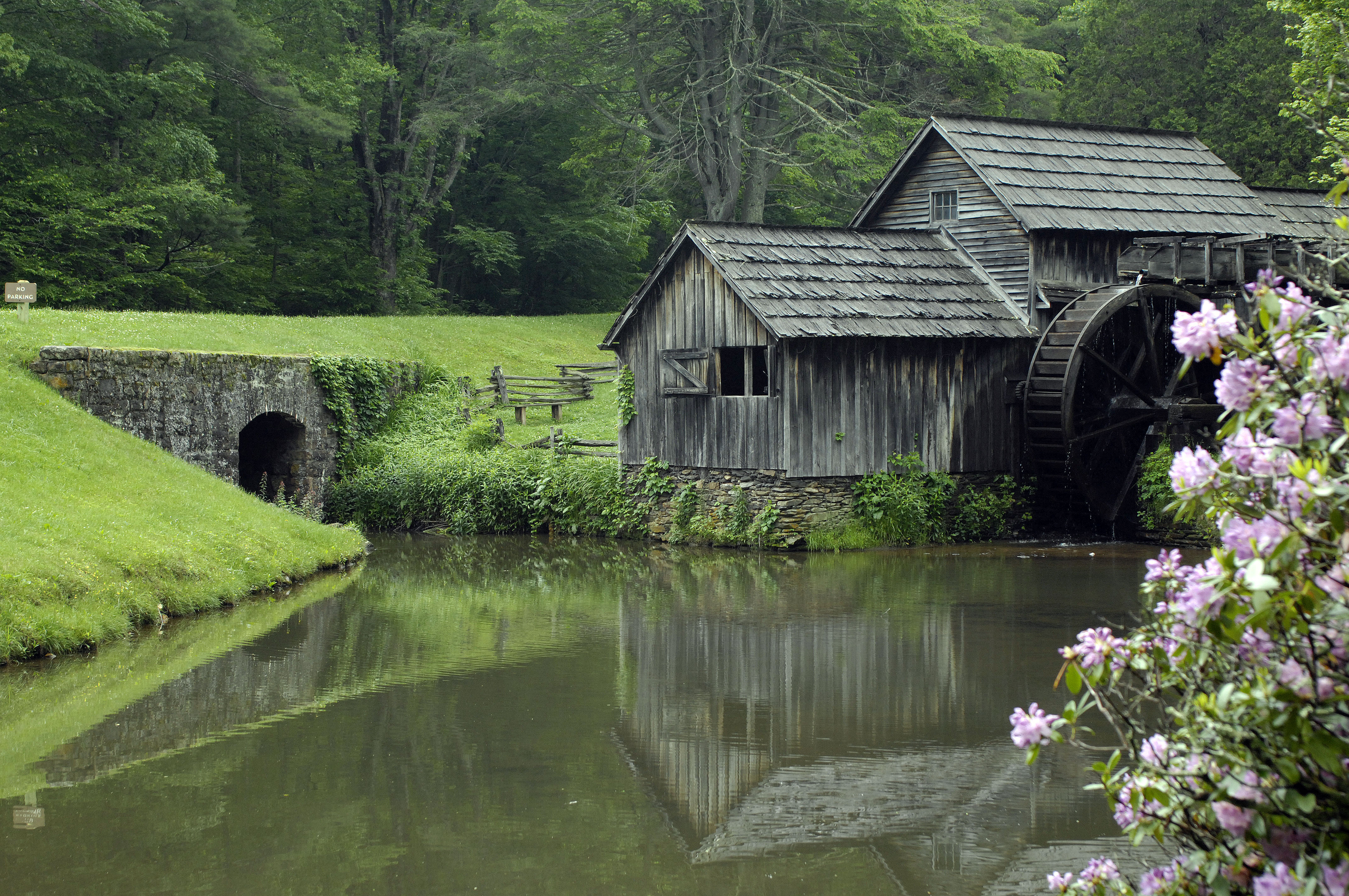
You’ll find Mabry Mill on the Blue Ridge Parkway at Milepost 176, just north of Meadows of Dan, Virginia. For those of you who live far away and may not be aware of it, the Blue Ridge Parkway actually is an American national park, a kind of linear national park that is 469 miles long. It’s a scenic two-lane road, closed to commercial traffic, built during Roosevelt’s New Deal, to create jobs during the Great Depression and to stimulate local economies. It runs along the crest of the Blue Ridge Mountains from Charlottesville, Virginia (the location of Thomas Jefferson’s Monticello), to the Nantahala National Forest in southwest North Carolina. The parkway will take you through Asheville, North Carolina, which is often called the San Francisco of the South. The parkway was a part of my childhood (my father was born in Carroll County, Virginia, in the Blue Ridge Mountains), and now the Blue Ridge Parkway is a part of my golden years.
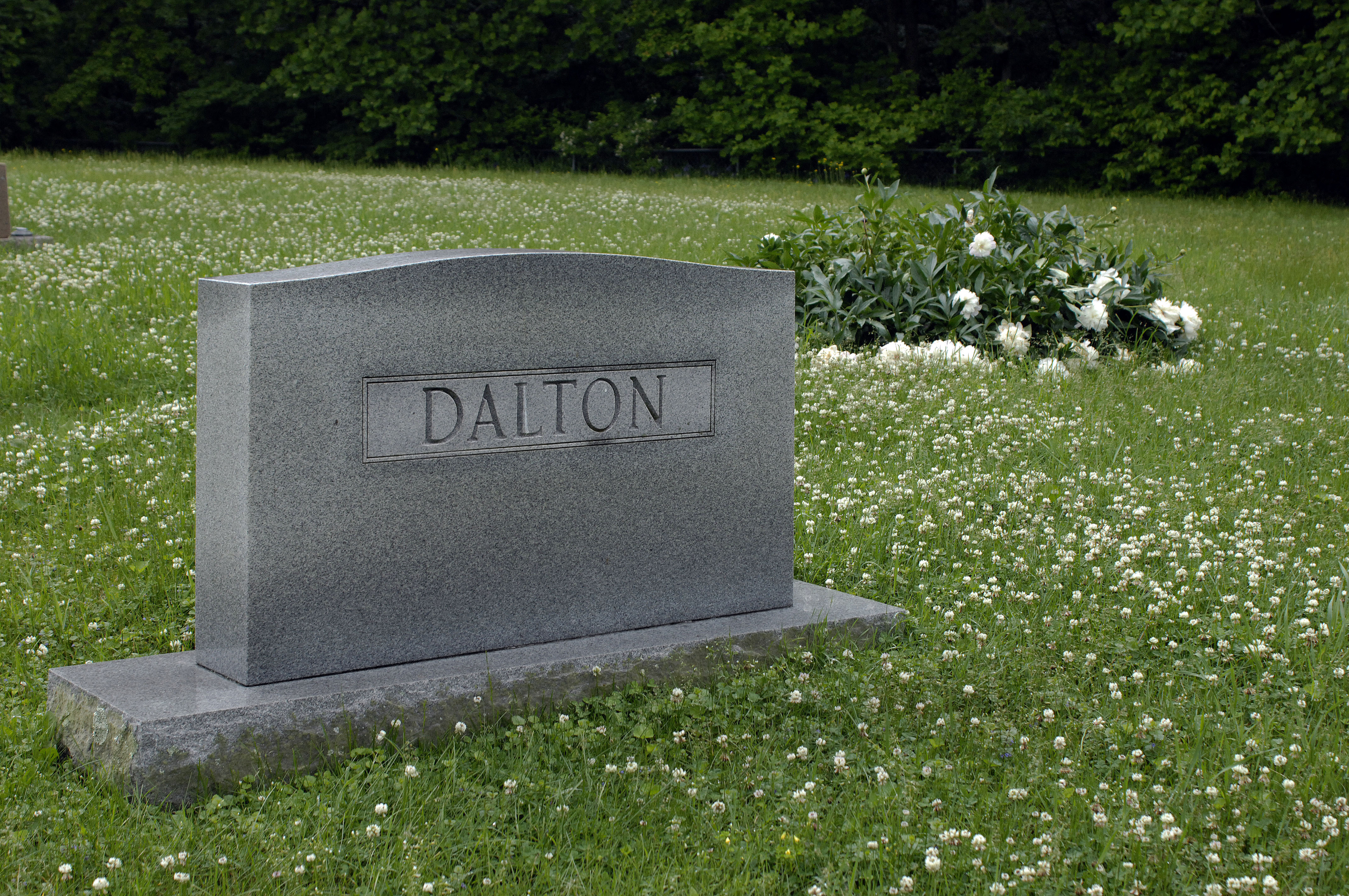
As I believe I have mentioned before in this blog, my maternal line intermarried with the Mayberry (later shortened to Mabry) family in the early 19th Century. I’m sure the records exist to connect my maternal ancestors with the family of Edwin Boston Mabry, who built the mill in 1867, but it’s not something I’ve gotten around to trying to figure out. Just behind Mabry Mill, actually, is a Dalton cemetery. I’ve included a photo below. These are my ancestral stomping grounds. My ancestors arrived in Carroll County, Virginia, right after the revolutionary war, from the Charlottesville area (Albemarle County). Before that they were in Tidewater Virginia. The Dalton Genealogical Society has never been able to determine with any certainty where the first Virginia Dalton originated (he is referred to as Timothy 1). Tradition says England. But the genetic evidence points much more strongly to Ireland.
Also note that this area has one of the darkest skies, with the least light pollution, of any area on the American East Coast. This is because there are no nearby cities. The surrounding terrain is mostly forest. Stop at an overlook pullover on the parkway near the Rocky Knob campground on a moonless night, just a few miles north of Mabry Mill, and you’ll get a good look at the Milky Way.
Another note on the photos: May 2018 was a very wet month, with a lot of rain in late May from tropical storm Alberto. The mountains were as green as Ireland when these photos were taken (May 30, 2018).
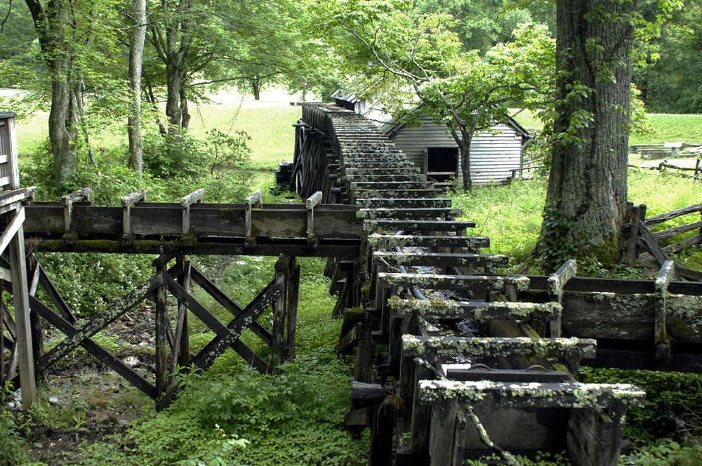
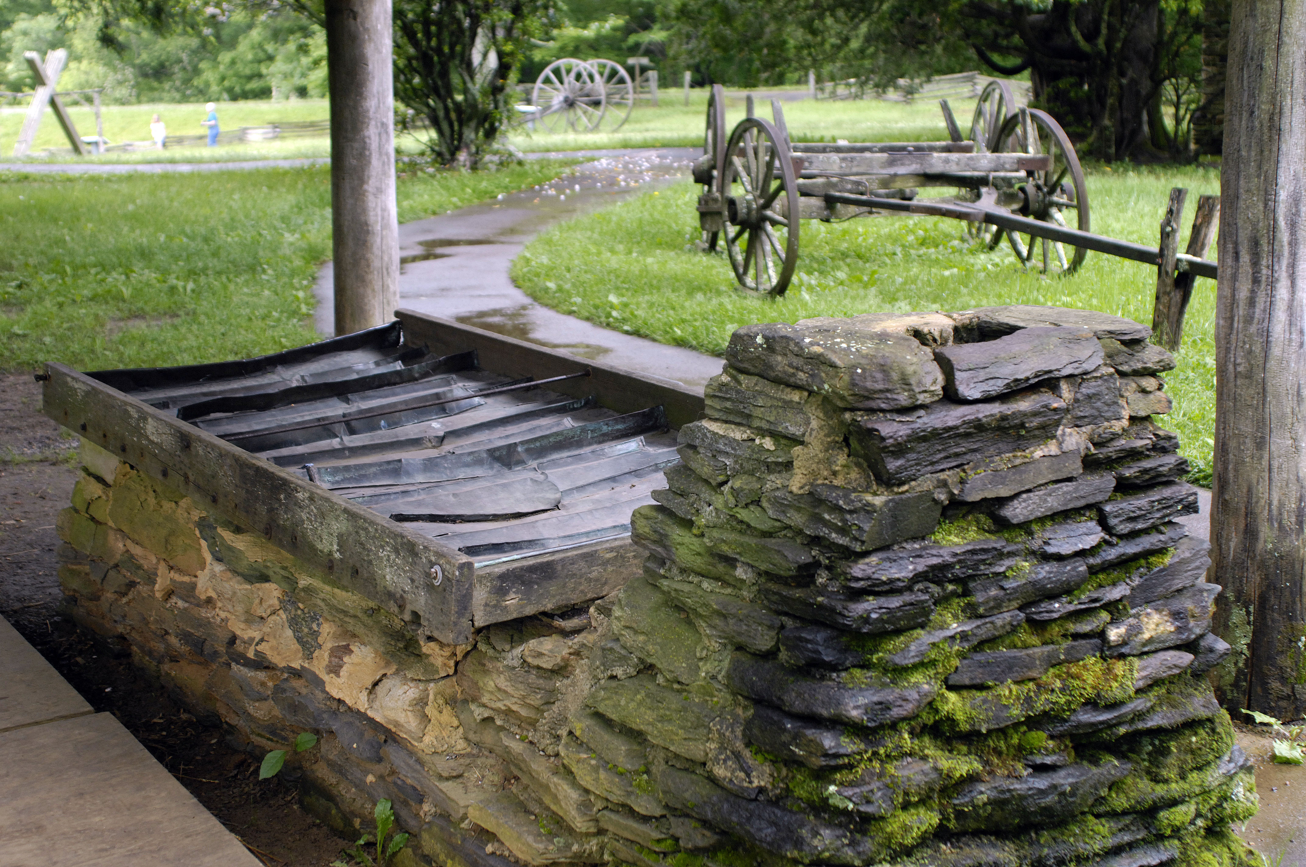
⬆︎ The mill’s water sluice now leaks so badly that there is not enough water to turn the water wheel. My understanding is that the U.S. Park Service does not at present have any plans to rebuild the sluice. Click here for high-resolution version.

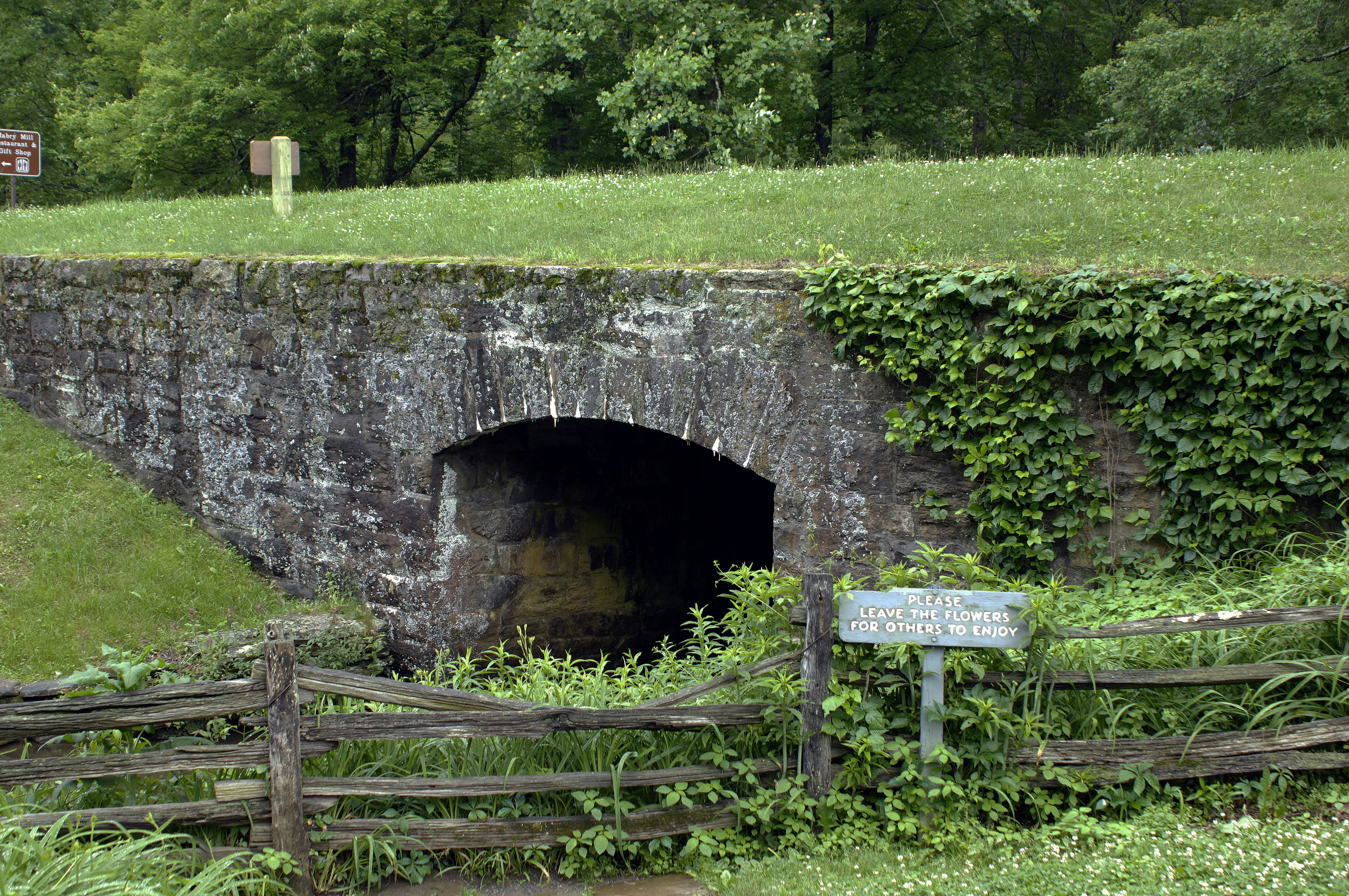
⬆︎ Here the outflow from the mill pond flows under the Blue Ridge Parkway. Click here for high-resolution version.
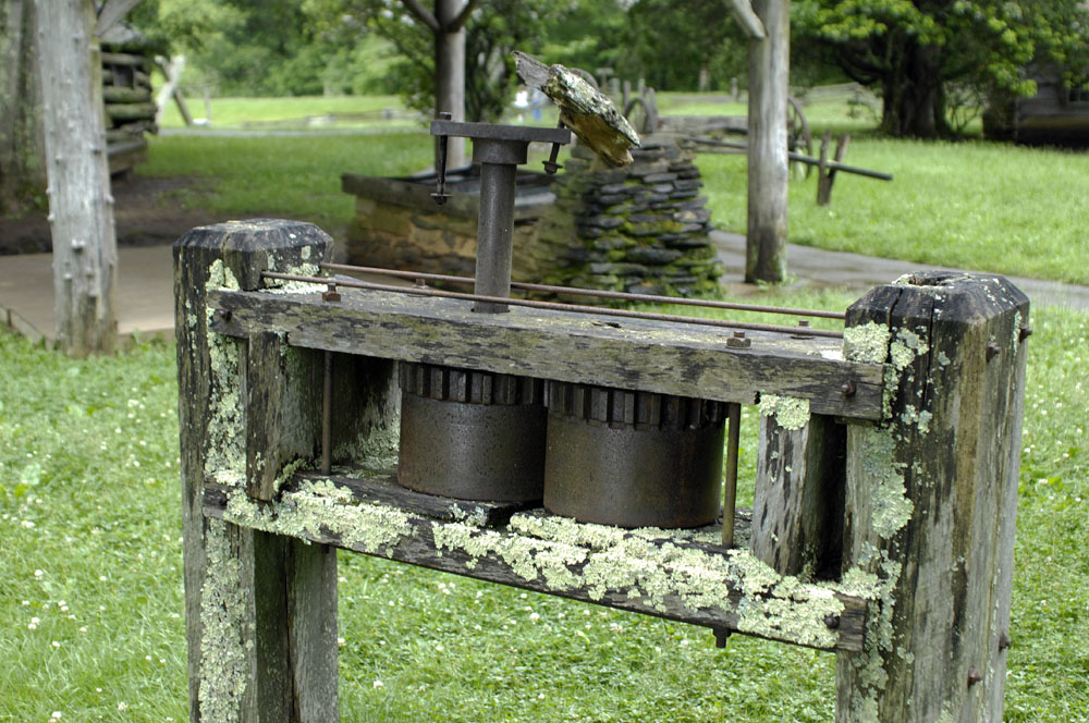
⬆︎ This was press for extracting the juice from sorghum stalks. The press was turned by a mule. See next photo. Click here for high-resolution version.

⬆︎ Here the sorghum juice was boiled down over a wood fire to make molasses. The mill did more than just grind grain. It also was a sawmill with a blacksmith shop and other light-industry services. Click here for high-resolution version.
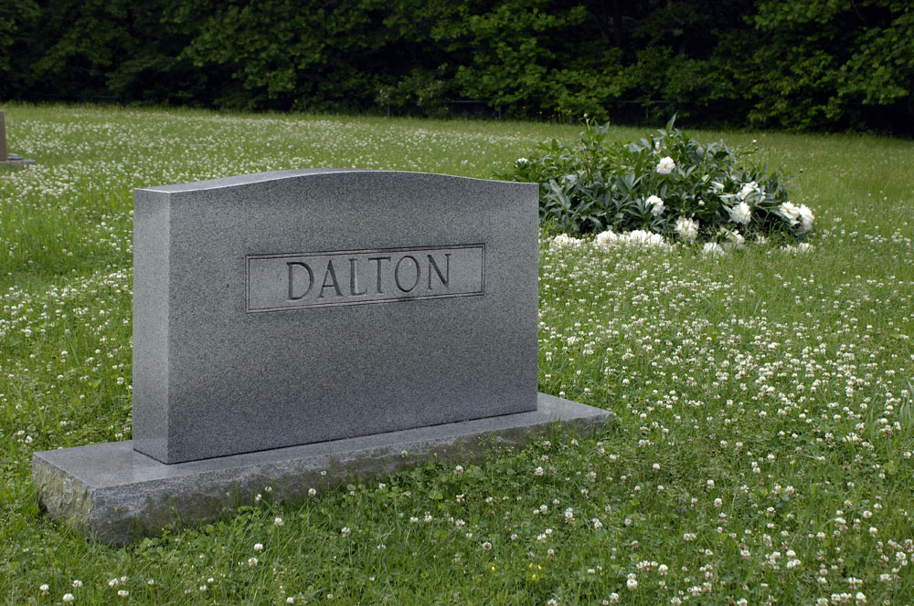
⬆︎ In the Dalton cemetery just behind Mabry Mill. Click here for high-resolution version.

⬆︎ Appalachian folk music is an important part of the local culture.
Thank you for the history lesson. I look forward to many more.
Great photos. I have been to that area many times. Beautiful scenery.