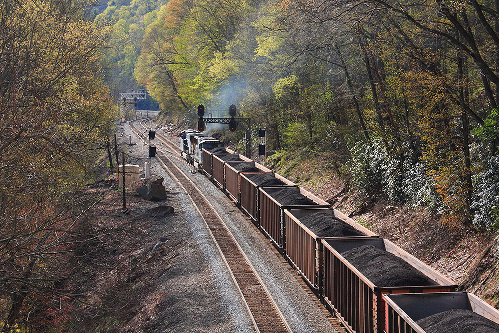
A coal train near Cotton Hill, West Virginia. Source: Jason Bostic, Flickr
As I mentioned recently, one of my New Year’s resolutions is to go on more hiking and picture-taking expeditions. When I made the resolution, I was vaguely aware that I wanted to focus on the Appalachian highlands. But I also wanted to get a bit more order and purpose into it — that is, to make a project out of it.
I think my plan is to follow the coal.
About 15 miles away, at Belews Creek, North Carolina, is the Belews Creek Steam Station, a coal-fired generating plant operated by Duke Energy. The plant burns massive amounts of coal and produces massive amounts of coal ash. The environmental consequences of this are a whole different story. But that whole different story also figures into my political and environmental activities in these parts. But back to the coal.
The coal that feeds the Belews Creek Steam Station comes from (where else?) West Virginia. The coal gets here from West Virginia on very long and very heavy coal trains. The route the coal trains follow is not hard to figure out using Google Earth and other online sources. The train line’s path from the steam station to West Virginia runs like this: Belews Creek (North Carolina), Madison, Stoneville, Martinsville (Virginia), Ferrum, Rocky Mount, Roanoke, Christiansburg, Ripplemead, Narrows, Princeton (West Virginia), and thence into a complex network of rail lines that bring coal out of the West Virginia mountains.
Railways (and trains) are remarkably photogenic. Most railway lines were built many decades ago. They tend to follow rivers, traveling through wild places to link old industrial cities. Their routes show us where industry was concentrated back in the days when the U.S. had industry.
So the photographic project I’m proposing for myself is to follow the coal train from Belews Creek (North Carolina) to Kopperston (West Virginia) or thereabouts. Such a project would take time — a couple of years, probably — with each segment requiring a separate road trip.
We’ll see!
If you’re interested in looking at railway lines in Google Earth (railway lines in the U.S., anyway) then with this link, you can find .kmz files for Google Earth. When loaded into Google Earth, the files draw the routes of the railways in Google Earth for most American railway lines. If you click on a railway, you can see who owns it, plus a bit of the railway’s history.
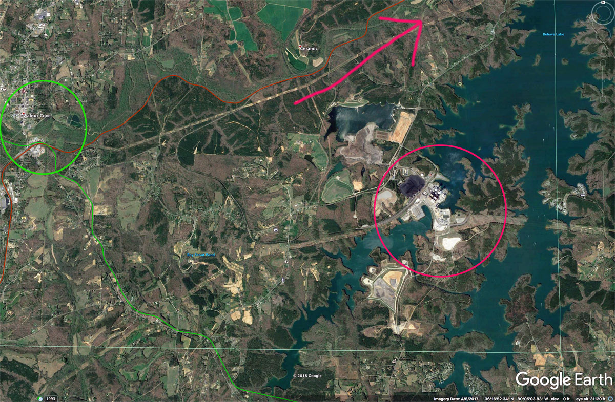
The Google Earth screen shot below shows the Belews Creek Steam Station (circled in red); the little town of Walnut Cove (circled in green); and the route the coal train follows toward Roanoke, Virginia (the red arrow). This train line dates back to 1889 and now belongs to Norfolk Southern Railway.
I plan to start shooting at Walnut Cove and the Belews Creek Steam Station and then, over time, work my way toward the coal mines of West Virginia. Following the train lines with Google Earth should help me zoom in on the most photogenic areas.